Current Road Condition and Route Map
| Select | Stop Name | Type | Location |
|---|---|---|---|
| Primm Valley Resorts | Gas / POI | Primm, NV | |
| World's Tallest Thermometer | Point of Interest | Baker, CA | |
| Barstow Station | Food / POI | Barstow, CA | |
| Boron Rest Area | Rest Area | Boron, CA | |
| Outlets at Tejon | POI / Gas | Arvin, CA | |
| Buttonwillow Travel Center | Gas / Food | Buttonwillow, CA | |
| Bravo Farms | Point of Interest | Kettleman City, CA | |
| Harris Ranch Resort | Food / Gas | Coalinga, CA | |
| Pea Soup Andersen's | Food / POI | Santa Nella, CA | |
| Westley Rest Area | Rest Area | Westley, CA |

Distance and estimated driving time
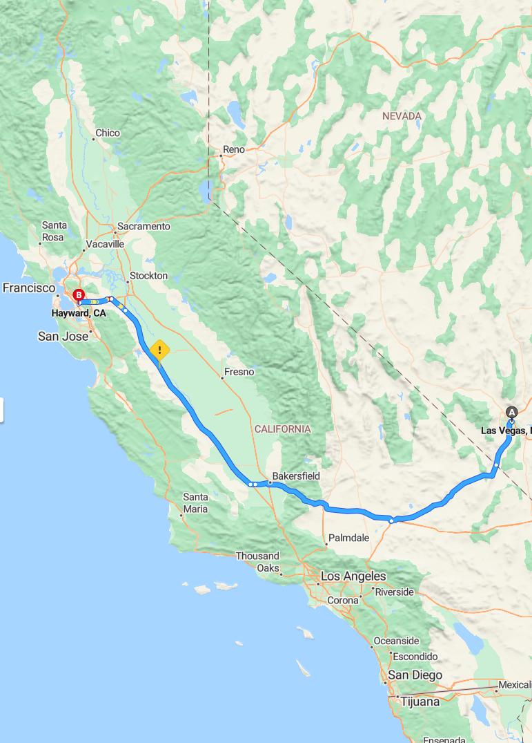
The drive from Las Vegas to Hayward covers approximately 543 miles via I-15 S and I-5 N, with an estimated travel time of around 9 hours and 29 minutes. This route takes you through diverse landscapes, including desert regions and urban areas, offering a scenic journey across California and Nevada. Planning ahead is essential to ensure adequate rest stops and fuel breaks along the way. Proper preparation can help make the long drive more comfortable and efficient.
Driving route
Traveling from Las Vegas, Nevada to Hayward, California offers a scenic and straightforward road trip through the southwestern United States. The journey begins in Las Vegas, renowned for its vibrant entertainment and iconic Strip, before heading westward on Interstate 15. As you pass through Bakersfield, California, you'll experience a change in landscape marked by agricultural expanses and the foothills of the Sierra Nevada. The final leg of the trip takes you through the diverse urban and suburban areas of the San Francisco Bay Area, culminating in Hayward, a vibrant city known for its community spirit and proximity to Silicon Valley. This route provides travelers with a mix of desert scenery, agricultural regions, and bustling city environments, highlighting the varied beauty of the western United States.
Best departure times for avoiding traffic
To avoid heavy traffic when driving from Las Vegas to Hayward, it is best to depart early in the morning, ideally around 4:00 to 6:00 AM, when most travelers have not yet begun their trips. Leaving during mid-morning or early afternoon can help you avoid peak congestion hours, especially near major cities like Bakersfield and the Bay Area. Planning your departure on weekdays rather than weekends further reduces the likelihood of encountering delays caused by recreational travelers. Additionally, checking live traffic updates before departure can help you choose the most efficient time to ensure a smoother journey.
Road conditions and weather forecast
The drive from Las Vegas to Hayward via Bakersfield currently features generally smooth road conditions, with well-maintained highways facilitating a comfortable journey. Drivers should be prepared for potential changes in weather, as areas in California may experience variable conditions, including occasional rain or fog, especially near the coast and within the Central Valley. The weather forecast predicts mild temperatures overall, but caution is advised during dusk and dawn when visibility can decrease due to fog or low-hanging clouds. It's recommended to stay updated on local traffic alerts and weather advisories to ensure a safe and efficient trip.
Traffic congestion and travel advisories
Traveling from Las Vegas to Hayward, CA, drivers should be prepared for potential traffic congestion, especially near major urban areas such as Bakersfield and the Bay Area. Construction projects, peak travel times, and holiday weekends can further impact traffic flow, causing delays. It is advisable to check real-time traffic updates and travel advisories before beginning your journey to avoid unexpected hold-ups. Staying informed about road conditions can help ensure a smoother trip and timely arrival at your destination.
Suggested rest stops and fuel stations
When driving from Las Vegas to Hayward, it's essential to plan rest stops and fuel stations for a comfortable journey. In Bakersfield, travelers can find numerous rest areas and well-equipped fuel stations, such as those along Highway 99, offering both hydration and refueling options. Planning breaks approximately every 2-3 hours will help reduce fatigue and ensure safety, especially at designated rest areas with amenities. Additionally, popular gas stations like Chevron and Shell are conveniently located in key cities along the route, providing reliable fuel options and opportunities to take short breaks before continuing your drive.
Scenic points of interest along the route
As you drive from Las Vegas to Hayward, you'll pass through a variety of scenic points of interest that enhance the journey. Starting in Las Vegas, the desert landscapes and the striking city skyline provide a unique, vibrant backdrop. As you approach Bakersfield, the rolling hills and expansive farmland offer a picturesque view of California's Central Valley. Closer to Hayward, the route along the California coast and nearby parks presents lush greenery, scenic overlooks, and stunning coastal vistas, making the drive both captivating and memorable.
Cost of tolls and parking options
Driving from Las Vegas to Hayward involves several toll and parking considerations. Tolls are generally minimal for this route, mainly on the California highways, but it's advisable to carry an electronic toll pass for convenience. Parking options in Hayward include public lots and street parking, which are typically affordable, though rates may vary based on location and duration. Planning ahead can help visitors find the most economical parking solutions and avoid unexpected toll expenses.
Transportation safety tips for long drives
When undertaking long drives from Las Vegas to Hayward, ensuring transportation safety is essential for a smooth journey. Before departure, conduct a thorough vehicle inspection, including checking tire pressure, fluid levels, and brakes, to prevent breakdowns. During the drive, take regular breaks to rest and stretch, reducing fatigue and increasing alertness on the road. Additionally, adhere to speed limits, avoid distractions, and stay vigilant for changing traffic conditions, especially when passing through busy areas like Bakersfield.
Alternative routes and detours
When traveling from Las Vegas to Hayward, travelers can consider alternative routes such as taking Interstate 15 south to Los Angeles before heading north on Interstate 5, which offers scenic views and may help avoid heavy traffic on the primary route via Bakersfield. Detours may be necessary due to road construction, accidents, or seasonal weather conditions, especially near mountain passes or coastal areas, so checking current road conditions beforehand is advisable. An alternative to the direct route is traveling east through the Mojave Desert and then north through Central California, providing a different landscape experience while potentially avoiding congestion on major highways. Planning ahead with real-time navigation apps can help identify the fastest and safest routes, ensuring a smoother journey regardless of detours or unexpected disruptions.

Leave a comment