Current Road Condition and Route Map
| Visited | Stop Name | Type | Description |
|---|---|---|---|
| Pagosa Springs | Point of Interest / Gas | Famous natural hot springs and various dining/fuel options. | |
| Treasure Falls | Point of Interest | A stunning 100-foot waterfall accessible via a short hike off US-160. | |
| Wolf Creek Pass Summit | Rest Area / POI | Continental Divide overlook with scenic mountain vistas. | |
| South Fork | Gas / Rest Area | Quiet mountain town ideal for a quick fuel stop and snacks. | |
| Alamosa | Gas / Point of Interest | Major hub with full services; gateway to Great Sand Dunes. | |
| Fort Garland Museum | Point of Interest | Historic 19th-century frontier army post and museum. | |
| North La Veta Pass | Rest Area | Scenic high mountain pass with pull-offs for photos. | |
| Walsenburg | Gas / Rest Area | Transition point from US-160 to I-25 with multiple gas stations. | |
| Colorado City Rest Area | Rest Area | Clean public facilities and tourist information off I-25. | |
| Pueblo Riverwalk | Point of Interest / Food | Scenic urban waterfront with shops, restaurants, and boat rides. |

Distance and estimated driving time
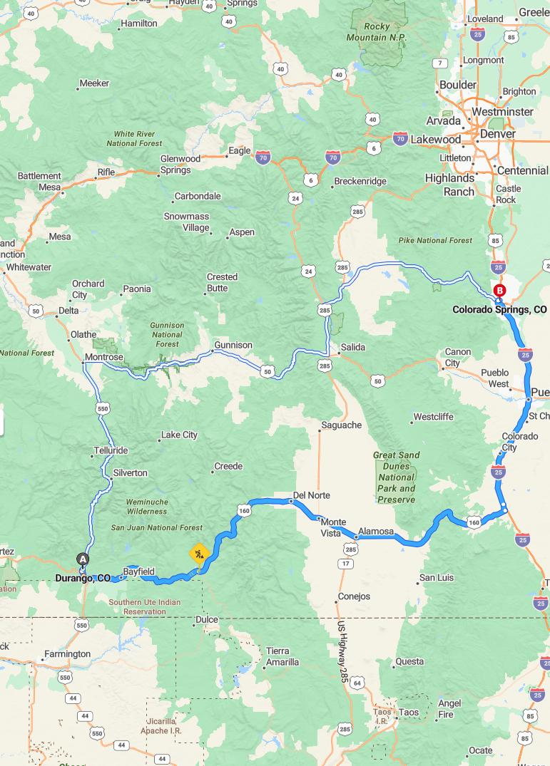
Driving from Durango to Colorado Springs covers approximately 315 miles via US-160 E and I-25 N, with an estimated travel time of around 5 hours and 25 minutes. This scenic route offers a relatively swift journey through diverse landscapes, making it an ideal trip for travelers seeking both efficiency and beautiful vistas. It's advisable to account for possible delays due to traffic or weather conditions along I-25 N. Planning ahead ensures a smooth and enjoyable drive from Durango to Colorado Springs, allowing you to make the most of your visit.
Driving route
Embarking on a scenic road trip from Durango to Colorado Springs, travelers will navigate through charming towns and breathtaking landscapes. The journey begins in Durango and passes through the picturesque Bayfield and historic Silverton, offering stunning mountain views, before reaching the charming mountain town of Ouray. Continuing northward, travelers encounter Montrose, Delta, and Orchard City, each with unique local flavors, then traverse the scenic Whitewater and Rifle areas, renowned for outdoor recreation. The route proceeds through the vibrant mountain communities of Glenwood Springs, Eagle, Vail, and Breckenridge, providing opportunities for outdoor activities and sightseeing. Finally, reaching the Denver metropolitan area, the trip concludes with a diverse array of cultural attractions before arriving in Colorado Springs, making for a memorable explorative journey across Colorado's diverse landscapes.
Best time to travel
The best time to travel from Durango to Colorado Springs depends on your preferences for weather and scenery. For mild temperatures and outdoor activities, late spring (May to June) and early fall (September to October) offer pleasant conditions and fewer crowds. Summer months (July and August) provide ideal weather for exploring, but can be busy due to tourism. Winter trips are perfect for winter sports enthusiasts, especially around Vail and Breckenridge, but require preparedness for colder conditions.
Road conditions and weather forecast
The road trip from Durango to Colorado Springs offers a scenic route with varying road conditions and weather patterns. Travelers can expect well-maintained highways through the flatter regions near Denver and Colorado Springs, while mountain passes like Silverton and Ouray may present snow or icy patches, especially in cooler months. Weather forecasts indicate fluctuating temperatures and potential snowfall in higher elevations, with sunnier conditions in the lower valleys. It is advisable to check current road alerts and weather updates before departure to ensure a safe and enjoyable drive through this diverse landscape.
Key landmarks and attractions along the route
The driving route from Durango to Colorado Springs offers a stunning array of landmarks and attractions. Travelers can explore the historic and scenic Silverton, renowned for its nearby mountain peaks and the Durango & Silverton Narrow Gauge Railroad. In Ouray, the "Switzerland of America," visitors enjoy dramatic waterfalls and hot springs, while Glenwood Springs features the world's largest hot springs pool and rugged canyon vistas. As you approach Denver and Colorado Springs, iconic sites like Red Rocks Amphitheatre and Garden of the Gods provide breathtaking natural beauty and cultural experiences characteristic of Colorado's diverse landscape.
Rest stops and fueling stations
During your drive from Durango to Colorado Springs, you will find numerous rest stops and fueling stations along the route, ensuring a comfortable journey. Popular rest areas are located in Silverton, Montrose, and Glenwood Springs, offering convenient spots for breaks and refreshments. Fueling stations are readily available in larger towns such as Ouray, Eagle, Vail, and Denver, allowing for seamless refueling sessions. Planning your stops in advance can help optimize your travel experience, providing opportunities to rest, refuel, and enjoy scenic views along the way.
Traffic updates and congestion zones
Traveling from Durango to Colorado Springs, drivers should be aware of potential traffic congestion in major urban areas such as Denver, Littleton, and Boulder, especially during peak hours. Notable congestion zones include the Denver metropolitan area and the intersections near Robinsdale, where increased commuter activity often causes delays. As you pass through mountain towns like Silverton, Ouray, and Vail, expect variable traffic conditions, particularly during weekends and holidays when tourist traffic peaks. Monitoring real-time traffic updates is recommended to navigate through these areas efficiently and ensure a smoother journey.
Safety tips for long-distance driving
When embarking on a long-distance drive like the trip from Durango to Colorado Springs, safety should be a top priority. Ensure your vehicle is in optimal condition by checking tire pressure, brakes, and fluid levels before setting out. Take regular breaks to rest and stretch, especially on mountainous and high-altitude segments such as Silverton, Ouray, and Vail, to stay alert and reduce fatigue. Additionally, stay informed about weather conditions and road closures along the route, and always carry an emergency kit, including first aid supplies, water, and warm clothing for unexpected situations.
Accommodation options near the route
Travelers along the Durango to Colorado Springs route can find diverse accommodation options to suit various preferences and budgets. In Durango and Colorado Springs, a wide range of hotels, cozy bed-and-breakfasts, and modern inns are available, providing comfortable stays with convenient access to city attractions. In smaller towns such as Silverton, Ouray, and Montrose, visitors can enjoy charming lodges, rustic cabins, and boutique guesthouses nestled in scenic settings. Whether seeking luxury resorts or budget-friendly motels, travelers have ample choices available in key locations along the route to enhance their road trip experience.
Navigation tools and travel apps
Effective navigation tools and travel apps are essential for a smooth journey from Durango to Colorado Springs, especially when traveling through scenic yet potentially challenging routes such as Silverton, Ouray, and Vail. GPS-based apps like Google Maps or Waze provide real-time traffic updates, alternate routes, and estimated arrival times, helping travelers avoid delays and road closures. Additionally, specialized travel apps can offer information on roadside services, gas stations, and points of interest along the way, enhancing overall trip convenience. Using these digital tools ensures a safer and more enjoyable travel experience across the diverse Colorado landscape.

Leave a comment