Current Road Condition and Route Map
| Visit | Stop Name | Category | Note |
|---|---|---|---|
| Jackson, CA | Gas & Food | Historic gold rush town; ideal for a full tank and a meal before the mountains. | |
| Silver Lake | Point of Interest | Scenic alpine lake along CA-88 perfect for a quick photo or stretch. | |
| Caples Lake | Rest Area | High-altitude lake with beautiful mountain vistas and parking areas. | |
| Hope Valley | Point of Interest | Expansive meadow known for stunning fall colors and wildlife viewing. | |
| Topaz Lake | Gas & Rest Area | Located on the CA/NV border; offers fuel, restrooms, and lake views. | |
| Bridgeport, CA | Gas & Food | Quaint mountain town; good spot to check tire pressure and grab snacks. | |
| Mono Lake Tufa Reserve | Point of Interest | Unique limestone rock formations (tufas) and ancient saline lake. | |
| Whoa Nellie Deli | Food & Gas | Famous gourmet deli located inside a gas station at the Tioga Pass junction. | |
| June Lake Loop | Point of Interest | A scenic detour just before Mammoth featuring four beautiful glacial lakes. | |
| Mammoth Lakes Welcome Center | Rest Area | Official visitor center to get local maps, trail info, and wilderness permits. |

Distance and estimated driving time
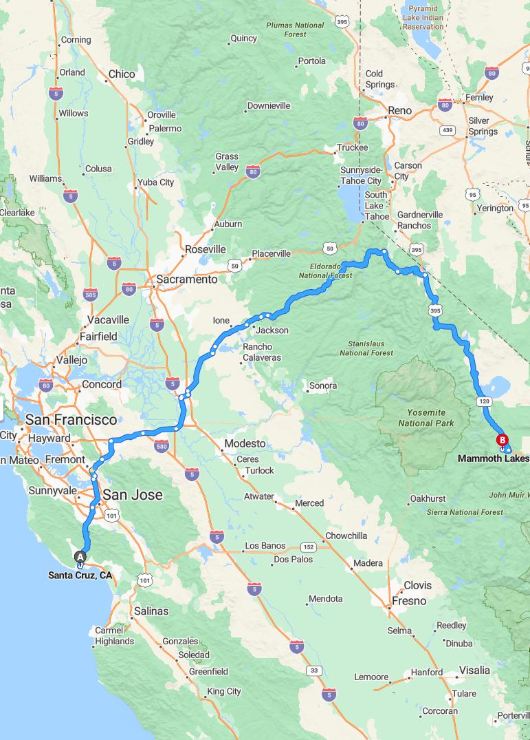
The drive from Santa Cruz to Mammoth Lakes covers approximately 344 miles via CA-88 and US-395 S. The estimated travel time for this route is around 6 hours and 13 minutes, depending on traffic conditions. This scenic journey takes you through diverse landscapes, offering picturesque views along the way. Ensuring your vehicle is well-prepared will help make this approximately six-hour trip smooth and enjoyable.
Driving route
Embarking on a scenic drive from Santa Cruz to Mammoth Lakes offers travelers a diverse landscape of California's highlights. The journey begins along the coast through charming towns like Salinas and Gilroy before heading inland through San Jose and Fremont, blending urban attractions with natural beauty. Continuing eastward, the route passes through historic Stockton and Lodi before reaching Sacramento, California's vibrant capital. As you ascend into the Sierra Nevada, enchanting stops at Placerville, South Lake Tahoe, and Meyers prepare you for the exhilarating ascent to Top of the World and finally culminate in the stunning vistas of Mammoth Lakes. This route showcases a perfect combination of coastal charm, agricultural richness, and mountain splendor, making it an unforgettable California adventure.
Road conditions and seasonal considerations
Traveling from Santa Cruz to Mammoth Lakes involves passing through diverse terrains and weather conditions. During winter months, snow and ice can significantly impact driving, especially near South Lake Tahoe and higher elevations like Top of the World, requiring chains or snow tires for safety. Spring and fall may bring variable weather, including rain and fog, which can reduce visibility and traction along the route. It is essential to check current road conditions and forecasts before your trip, and carry necessary emergency supplies to ensure a safe journey through the mountain passes and less maintained roads.
Key scenic spots along the route
The drive from Santa Cruz to Mammoth Lakes offers a variety of breathtaking scenic spots, beginning with the vibrant coastal views of Santa Cruz. Traveling inland, Salinas and Gilroy provide charming agricultural landscapes, while San Jose and Fremont showcase urban beauty amid lush parks. As you ascend toward Sacramento and Placerville, the route features picturesque gold rush-era towns and rolling foothills. The journey culminates in the stunning alpine scenery of South Lake Tahoe, Meyers, and the mountainous vistas surrounding Mammoth Lakes, offering travelers a diverse array of natural splendor throughout their adventure.
Average fuel consumption and gas stations
The drive from Santa Cruz to Mammoth Lakes covers approximately 300 miles, with an average fuel consumption of about 25 miles per gallon for most vehicles. Gas stations are conveniently located along the route in major towns like Salinas, Gilroy, San Jose, and Sacramento, ensuring easy refueling options. Travelers should plan their stops accordingly, especially near popular areas such as South Lake Tahoe and Meyers, where fuel prices may vary. To ensure a smooth journey, it's advisable to fill up at larger stations in urban centers and keep an eye on fuel levels when passing through more remote sections like Top of the World and Mammoth Lakes.
Recommended stops and rest areas
While traveling from Santa Cruz to Mammoth Lakes, consider stopping at key points like San Jose and Fremont for fueling and refreshments. Rest areas are conveniently located along I-80 in Stockton and Galt, offering comfortable spots to stretch and rejuvenate. For scenic breaks, stop at South Lake Tahoe or Placerville to enjoy beautiful views and fresh air. For a longer break, take advantage of designated rest areas near Sacramento and Meyers to ensure a safe and enjoyable journey.
Weather forecast during travel time
During your journey from Santa Cruz to Mammoth Lakes, travelers can expect varied weather conditions. Along the coastal regions such as Santa Cruz and San Jose, mild and temperate weather is typical, though fog may occasionally reduce visibility. As you ascend inland through cities like Sacramento and Placerville, temperatures are expected to be warmer, but increased elevation near South Lake Tahoe and Meyers may bring cooler temperatures and potential snow or rain. Typically, the weather at higher elevations around Mammoth Lakes favors colder, possibly snowy conditions, especially during the late autumn or early winter months, so travelers should prepare accordingly.
Vehicle requirements and safety tips
When driving from Santa Cruz to Mammoth Lakes, ensure your vehicle is well-maintained, with tires properly inflated and brakes functioning optimally for the varied terrain. Carry essential safety supplies such as water, a first aid kit, and emergency tools, especially as you traverse remote areas like South Lake Tahoe and Meyers. Be prepared for changing weather conditions, particularly at higher elevations, by maintaining a full tank of gas and checking tire chains, as they may be required in snowy conditions near Top of the World. Finally, adhere to traffic laws and drive cautiously, especially on mountain roads and in areas susceptible to weather-related hazards, to ensure a safe and pleasant journey.
Local attractions near Mammoth Lakes
Mammoth Lakes is surrounded by stunning natural attractions that captivate visitors year-round. Nearby, visitors can explore the breathtaking views at Top of the World, offering panoramic vistas of the Sierra Nevada. The area is also renowned for its pristine lakes, including Lake Mary and Horseshoe Lake, perfect for fishing, kayaking, and picnicking. Additionally, the nearby Devils Postpile National Monument features unique basalt columns and scenic hiking trails, making Mammoth Lakes a premier destination for outdoor enthusiasts.
Travel tips for a smooth journey
To ensure a smooth journey from Santa Cruz to Mammoth Lakes, plan your trip during off-peak hours to avoid heavy traffic, especially when passing through busy cities like San Jose and Stockton. Make sure your vehicle is well-maintained, with tires, brakes, and fluids checked before departure, and pack an emergency kit for safety. Staying hydrated and taking regular breaks at scenic spots like South Lake Tahoe and Placerville can improve your driving experience and keep you alert. Additionally, keep updated on weather conditions and road closures along the route to adjust your plans if necessary, ensuring a safe and enjoyable trip.

Leave a comment